IMPORTANCE OF GROUNDWATER

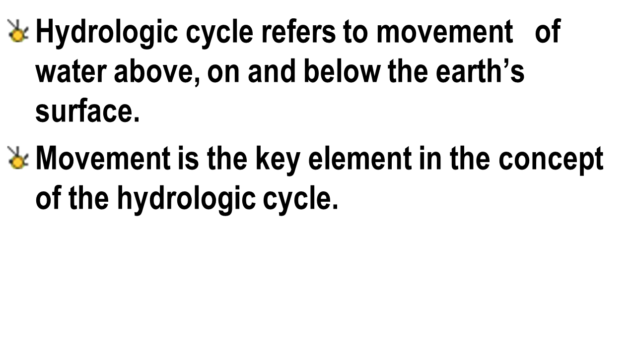
GROUNDWATER AND THE HYDRO
LOGIC CYCLE
INTRODUCTION
Groundwater is water
located beneath the earth's surface in soil pore spaces and in the fractures of
rock formations. The depth at which soil pore spaces or fractures and voids in
rock become completely saturated with water is called the water table
SUBSURFACE
WATER
water in a soil mantle
is called as sub surface water. Water beneath the surface can essentially be
divided into two zones.
- the unsaturated zone (also known as the "zone of aeration") which includes soil water zone
- the zone of saturation which includes ground water.
- sometimes, especially during times of high rainfall, these pore spaces are filled with water.
- the water table divided the zone of aeration from the zone of saturation.
- in the saturation zone, all the pores of soil are filled with water.
- in the aeration zone, soil pores are partially saturated with water
- The aeration zone has 3 sub-zones.
i.
Soil water zone
ii.
Intermediate zone
iii.
Capillary fringe
SOIL WATER ZONE
- Soil water is held in the pore spaces between particles of soil.
- Soil water is the water that is immediately available to plants.
- This water can be removes by air drying or by plant absorption, but cannot be removed by gravity.
- Plants extract this water through their roots until the soil capillary force (force holding water to the particle) is equal to the extractive force of the plant root.
- At this point at the plant cannot pull water from the plant-rooting zone and it wilts (called the wilting point).
- The amount of held in the soil after excess water has drained is called the field capacity of the soil.

INTERMEDIATE ZONE
- This is the layer is available next to the soil water zone.
- It lies in between the soil water zone and the capillary zone.
CAPILLARY ZONE
- The capillary fringe is the subsurface layer in which groundwater seeps up from a water table by capillary action to fill pores.
- Pores at the base of the capillary fringe are filled with water due to tension saturation.

- This saturated portion of the capillary fringe is less than total capillary rise because of the presence of a mix in pore size.
- If pore size is small and relatively uniform, it is possible that soils can be completely saturated with water for several feet above the water table.
- Alternately, the saturated portion will extend only a few inches above the water table when pore size is large.
- Saturated zone is classified into 4 categories.
i. Aquifer
ii. Aquiclude
iii. Aquifuge
iv. Aquitard


POROSITY
The
percentage of open spaces within the rock.
Fraction of total volume of porous media occupied by pores
Fraction of total volume of porous media occupied by pores

Porosity tells us the maximum amount of water that a rock can contain when it saturated.


SPECIFIED YIELD
Tell hoe much water is available foe man’s use

Storage Coefficient (For Confined Aquifer).
Determine the
storage coefficient and specific storage according to Jacob and DeWeist
analysis.Given that the thickness of a confined aquifer is 56m and has a
porosity of 0.2
α = 1.5 x 10⁻⁹
cm2/dyn, ẞ = 5 x 10⁻¹⁰ cm2/dyn
Solution
S
= ρgb (α+ηẞ) = ϒwb(α+ηẞ)
S
= 980dyn/cm3 x 56m x 100cm/1m {(1.5x10⁻⁹) + (0.2 x (5x10-10)}
cm2/ dyn
S
= 8.78 X10⁻³
Specific Storage.
Using Jacob Analysis;
Ss
= S/b =8.78x10⁻³/56m x 1m/100cm
Ss
= 1.57 X10⁻⁶ per cm
Using DeWiest analysis;
Ss
= ϒw [ ( 1 – η ) α + ηẞ ]
Ss
= 980 dyn/cm3 x [ ( 1 – 0.2 )( 1.5 x 10⁻⁹ ) + ( 0.2 )( 5
x 10-10 ) ] cm2/dyn
Ss
= 1.32 x 10⁻⁶ per cm
Hydraulic
Conductivity And Permeability
Aquifers transmit water from recharge
areas to discharge areas and thus function a
porous conduit
Permeability =
a measure of the rate that groundwater can flow through rock or regolith
Hydraulic conductivity
– The volume of water that will in a unit of time under a unit hydraulic
gradient through a unit area.
Example: Steady State Flow
A 200 mm diameter well which fully
penetrating a confined aquifer of thickness 25 m is pumped at a constant rate
of 2000 m3/day. The steady state drawdown in the well is 8 m and the drawdown
in a piezometer 100 m from the well is 1.4 m.
1. Ignoring well losses,
calculate the transmissivity of the aquifer, the hydraulic conductivity of the aquifer material and the
radius of influence of the well.
2. Repeat the calculation for
an unconfined aquifer with saturated thickness 25 m.
3. What would be the
calculated values of T, K and R in (a) if the well is 80% efficient?
answer


TRANSMISSIVITY (T)
Represents the rate of flow transmit water per unit width of the aquifer, under
unit hydraulic gradient.
The
‘T’
of an aquifer is equal
to the hydraulic conductivity of the aquifer multiplied by the saturated
thickness of the aquifer. Thus;
Coefficient of Leakage (Leakance, Le).
-
Leakance, Le
or coefficient of leakage was introduced by Hantush in 1964.
-
It is where water leaks
out from an aquifer as a team characteristic of semi-pervious confining layer.

Le =
leakance
b’=
thickness of semi pervious layer
K =
coefficient of permeability of semi pervious layer
K = coefficient of permeability of aquifer
The retardation
coefficient, a and leakage factor, ẞ are represented by the following equation:

Darcy’s
Law
•Darcy’s
law provides an accurate description of the flow of ground water in almost all hydrogeologic
environments.
•Henri Darcy established empirically that the flux of water through a permeable formation is proportional to the distance between top and bottom of the soil column.
•The constant of proportionality is called the hydraulic conductivity (K).
•V = Q/A, V a – ∆h, and V a 1/∆L
V = – K (∆h/∆L)
and since
Q
= VA (A = total area)
Q
= – KA (dh/dL)
Conditions
•Darcy’s
Law holds for:
1. Saturated flow and unsaturated flow
2.
Steady-state and transient flow
3. Flow in aquifers and aquitards
4. Flow in homogeneous and heterogeneous systems
5. Flow
in isotropic or anisotropic media
6. Flow in rocks and granular media
example
•A
confined aquifer has a source of recharge.
•K
for the aquifer is 50
m/day, and n is 0.2.
•The
piezometric
head in two wells 1000
m apart is 55 m
and 50 m
respectively, from a common datum.
•The
average thickness of the aquifer is 30
m, and the
average width of aquifer is 5 km.
Compute:
•a)
the rate of flow through the aquifer
•(b)
the average time of travel from the head of the aquifer to a point 4 km downstream
•*assume
no dispersion or diffusion

The solution
•Cross-Sectional
area= 30(5)(1000)
= 15
x 104
m2
•Hydraulic
gradient = (55-50)/1000
= 5
x 10-3
•Rate
of Flow for K = 50 m/day Q =
(50 m/day) (75 x 101
m2) = 37,500 m3/day
Darcy
Velocity: V
= Q/A
= (37,500m3/day)
/ (15 x
104 m2) = 0.25m/day
And
•Seepage Velocity:
Vs =
V/n = (0.25) / (0.2) = 1.25 m/day (about 4.1 ft/day)
•Time to travel 4 km downstream:
T
= 4(1000m) / (1.25m/day) = 3200 days or 8.77 years
•This example shows that water moves very slowly underground.d.
•a)
the rate of flow through the aquifer
•(b)
the average time of travel from the head of the aquifer to a point 4 km downstream
•*assume
no dispersion or diffusion

•Cross-Sectional
area= 30(5)(1000)
= 15
x 104
m2
•Hydraulic
gradient = (55-50)/1000
= 5
x 10-3
•Rate
of Flow for K = 50 m/day Q =
(50 m/day) (75 x 101
m2) = 37,500 m3/day
Darcy
Velocity: V
= Q/A
•Seepage Velocity:
Vs =
V/n = (0.25) / (0.2) = 1.25 m/day (about 4.1 ft/day)
•Time to travel 4 km downstream:
T
= 4(1000m) / (1.25m/day) = 3200 days or 8.77 years
•This example shows that water moves very slowly underground.d.
Unconfined flow between two bodies
A channel
runs almost parallel to a river, and they are 2000 ft apart.
The water level in the river is at an elevation of 120
ft and 110ft in the channel.
A pervious formation averaging 30 ft thick and with K
of 0.25 ft/hr joins them.
Determine the rate of seepage or flow from the river
to the channel
• Consider
a 1-ft length of river (and channel).
Q
= KA [(h1 – h2) / L
•
Where:
A = (30 x 1) = 30 ft2K
= (0.25 ft/hr) (24 hr/day)
=6 ft/day
Therefore,
Q = [6 (30) (120 – 110)] / 2000
= 0.9 ft3/day/ft length = 0.9 ft2/day
What Is A Pumping Test?
The goal of a pumping test, as in any aquifer test, is to estimate hydraulic properties of an aquifer system. For the pumped aquifer, one seeks to determine transmissivity, hydraulic conductivity (horizontal and vertical) and storativity (storage coefficient). In layered systems, one also uses pumping tests to estimate the properties of aquitards (verticalhydraulic conductivity and specific storage). Pumping tests can identify and locate recharge and no-flow boundaries that may limit the lateral extent of aquifers as well.
Pumping Test
What Is A Pumping Test?
A pumping test is a controlled field experiment in which a well is pumped at a controlled rate and water-level response (drawdown) is measured in one or more surrounding observation wells and optionally in the pumped well (control well) itself. Aquifer test and aquifer performance test (APT) are alternate designations for a pumping test. In petroleum engineering, a pumping test is referred to as a drawdown test.
The goal of a pumping test, as in any aquifer test, is to estimate hydraulic properties of an aquifer system. For the pumped aquifer, one seeks to determine transmissivity, hydraulic conductivity (horizontal and vertical) and storativity (storage coefficient). In layered systems, one also uses pumping tests to estimate the properties of aquitards (verticalhydraulic conductivity and specific storage). Pumping tests can identify and locate recharge and no-flow boundaries that may limit the lateral extent of aquifers as well.
Methods
1) Constant-rate tests maintain pumping at the control well at a constant rate.
2) Step-drawdown tests proceed through a sequence of constant-rate steps at the control well to determine its well loss and well efficiency characteristics.
3) Recovery tests use water-level (residual drawdown) measurements after the termination of pumping. A recovery test is an essential element of any pumping test.
Designing a Pumping Test
The following concepts should factor into the design of a pumping test:
1) time of year for pumping test
2) natural agents of groundwater fluctuation such as barometric pressure changes, earth tides and tidal variations which may affect water levels in observation wells during the pumping test
3) off-site groundwater use which may influence water levels during the pumping test
4) effects of pumping test on surrounding water users
5) depth setting and type of pump in control well
6) pumping duration and rate
7) pumping rate measurement and control
8) water-level measurement and frequency
9) disposal of pumped water
10) collection of water quality samples during pumping
11) location and orientation of streams, faults, lithologic contacts and other potential aquifer boundaries
12) potential for salt water intrusion in coastal areas
Field Equipment Checklist
The following is a list of possible
equipment needed for a pumping test:
1) generator
2) submersible pump
3) discharge pipe, connections
4) flow measurement device(s)
5) tape measure(s)
6) pressure transducer(s), cables,
data logger(s)
7) electric water-level sounder(s)
and batteries
8) steel tape(s) and chalk
9) watches/stopwatches
10) barometric sensor
11) thermometer
12) pH and conductivity meters
13) sample bottles
14) toolkit, electrical tape, wire
ties, heat shrinks
15) flashlights/lanterns
16) graph paper (semilog, log)
and/or computer software
17) data collection forms, log
book, permanent-ink pens
18) calculator
19) references, standard operating
procedures
20) manufacturer's operating
manuals for equipment
The foregoing equipment list is provided as a general guide for a typical pumping test and should not be considered exhaustive.
Modify/supplement the list to meet the requirements of your specific test.
Before start the test
There are several things you should consider before starting a pumping test:
1) Pumping tests should be carried out at or near the proposed rate of water take.
2) Avoid influences such as the pumping of neighbouring wells shortly before or during the test and for a period of recovery afterward.
3) Monitor neighbouring wells during the test if it’s likely they will be affected.
4) Make sure water discharged during the test does not interfere with shallow aquifer tests or cause unfavourable effects such as erosion.
Test duration
There is no set time for how long a pumping test should take. A pumping test should continue long enough to determine the effects of the proposed pumping.
As a guide, a minimum 24 hour constant rate test is generally required.
Tests taking longer than 24 hours may be required for large takes, such as community supplies, or situations where it may take longer to determine effects.
Measured
How an aquifer responds to pumping can be estimated by measuring:
transmissivity - the thickness and permeability of an aquifer (how easily water can enter)
storativity – how much water is stored in an aquifer.
Date, location and site diagram.
Contact details for the well owner and consultant.
Drawdown measurements, time of measurement and flow rate (including soft copy).
Well logs and construction details for all wells monitored.
Estimated characteristics of the aquifer (including transmissivity and storativity) and assessment of effects.
storativity – how much water is stored in an aquifer.
Test reports
Pumping test reports should include
the following:
Date, location and site diagram.
Contact details for the well owner and consultant.
Drawdown measurements, time of measurement and flow rate (including soft copy).
Well logs and construction details for all wells monitored.
Estimated characteristics of the aquifer (including transmissivity and storativity) and assessment of effects.